Remediation & enabling works: HS2, Birmingham
McAuliffe was contracted to carry out extensive remediation, enabling works and archaeological support on this high-profile site, which sits at the heart of the High Speed 2 line.
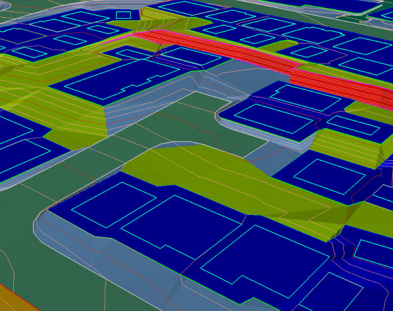
By creating a detailed 3D model of your site, McAuliffe optimises ground levels and delivers the best-value foundation solution for your development.
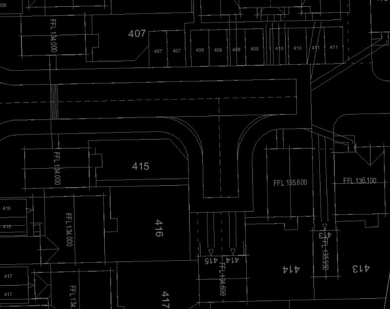
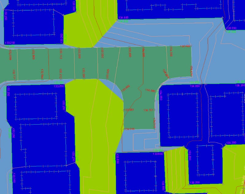
Our in-house engineers use topographical data to create a site outline. We then build on this with layers of information to develop a blueprint that’s bespoke to your project.
Working within client-specific parameters, McAuliffe models individual plots, gardens, roads and driveways, as well as slopes, ponds, retaining walls and public open spaces. We advise on the precise volume of material you need to excavate or fill, which is phased to your build programme together with any identified surplus or shortfall.
This information is uploaded onto our onsite plant, allowing us to accurately deliver and transmit real-time site data directly between the office and the hands of the machine operator. We use this information to create real-time, as-built models that inform foundation design and completed areas for handover as well as final regulatory sign-off.
Having detailed data from the outset makes compliant materials management through our intelligent plant simple.